From Glacier to Jungle: The Ecosystems of the Salkantay Route
The Salkantay Trek is often described as an alternative route to Machu Picchu. Geographically, that description barely scratches the surface. What makes this route exceptional is not only where it ends, at Machu Picchu, but how radically the environment changes along the way.
In just a few days, you move from high Andean farming valleys to glacial alpine terrain, descend into mist-filled cloud forest, and finish in tropical agricultural zones connected to the Amazon basin. The elevation range spans roughly 2,000 meters to 4,630 meters (6,500 ft to 15,190 ft), and that vertical drop creates stacked ecosystems that would normally be separated by thousands of kilometers horizontally.
1. Andean Meadows and Pre-Puna Valleys
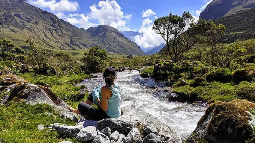
Mollepata & Soraypampa Region
The trek begins in broad, open valleys framed by snow-capped peaks. This is the transition zone between traditional Andean agriculture and higher alpine terrain.
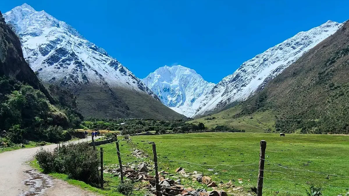
Landscape
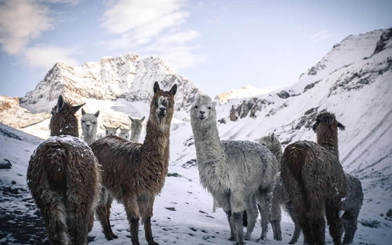
Rolling hills, glacial streams, and wide grazing lands dominate the scenery. The striking presence of Humantay Peak and its turquoise glacial lake immediately signal the proximity of ice-fed ecosystems.
Vegetation
This zone supports:
- Andean grasslands
- Low shrubs
- Cultivated crops such as potatoes, corn, and quinoa
The soils are fertile thanks to centuries of glacial erosion and sediment deposition. Meltwater descending from higher glaciers feeds irrigation channels that local communities still rely on today.
Fauna
Wildlife here is both domesticated and native:
- Llamas and alpacas grazing in open pastures
- Andean geese near streams
- Caracara birds scanning the ground
- Occasional sightings of the Andean fox
This is where human life and high-altitude ecology coexist most visibly. Agriculture fades gradually as altitude increases, replaced by species adapted to thinner air and colder conditions.
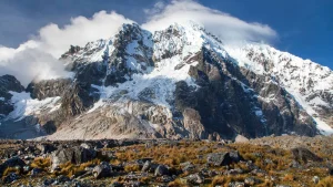
2. The High Mountain Ecosystem — The Puna
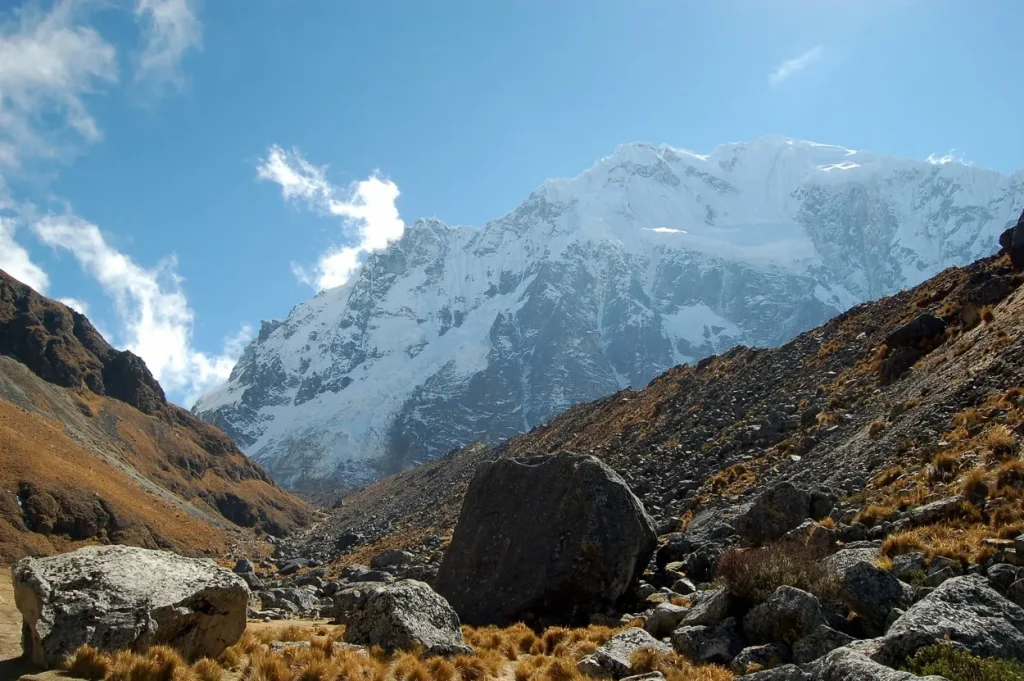
Above 4,000m / 13,100 ft
As the trail climbs toward the Salkantay Pass, the highest point at 4,630m, vegetation thins dramatically. Trees disappear. Crops vanish. The terrain becomes mineral and exposed.
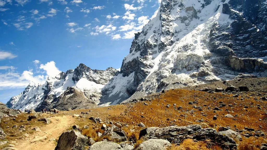
Terrain
Glacial moraines, granite walls, and scree slopes dominate the landscape. The massive presence of Apu Salkantay, a sacred mountain in Andean cosmology, towers above the route.
This environment is shaped by ice, wind, and extreme temperature variation.
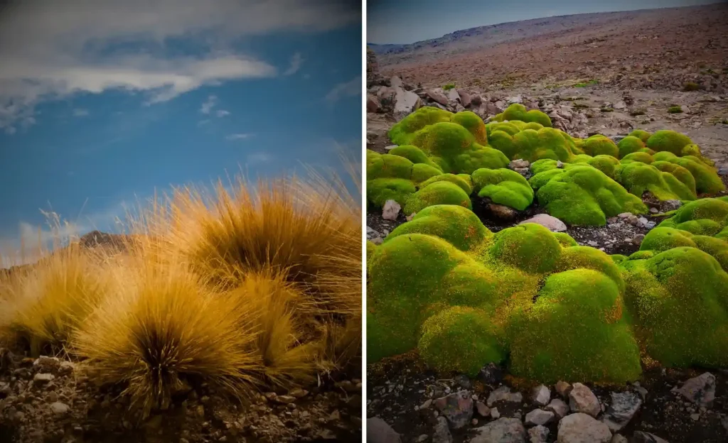
Flora
Plant life survives here through specialization:
- Ichu grass (a hardy Andean bunchgrass)
- Cushion plants that retain heat
- Lichens clinging directly to rock surfaces
Biodiversity decreases in quantity but increases in adaptation. Every species here is engineered for survival.
Fauna
Wildlife becomes more discreet:
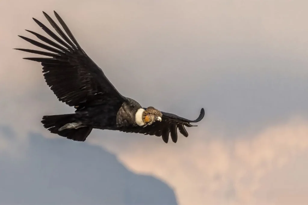
- Andean condors (rare but possible sightings)
- Small high-altitude rodents
- Specialized insects
- Vicuñas in some extended areas of the Andes
Environmental conditions are harsh:
- Strong UV radiation
- Thin oxygen levels
- Temperature swings of up to 20°C within a single day
This is an ecosystem built on resilience. Above the treeline life simplifies, but it does not disappear.
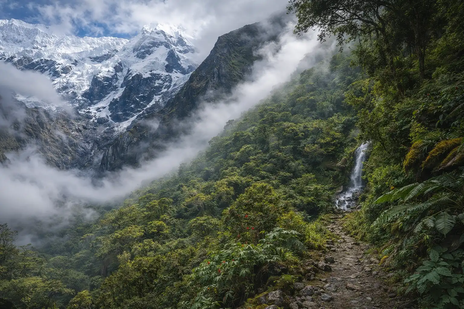
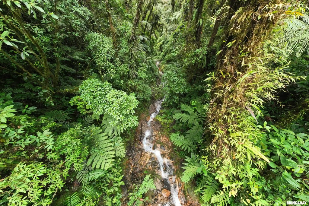
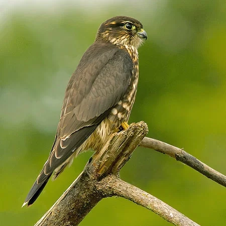
3. The Cloud Forest — Ceja de Selva
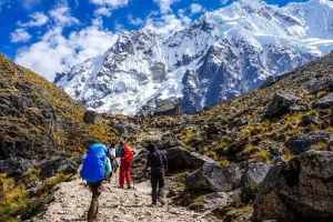
The descent from Salkantay Pass introduces one of the most dramatic ecological shifts on the continent.
Within hours, the dry alpine air transforms. Humidity rises. The air warms. Mist forms as Amazonian moisture meets Andean slopes. You have entered the “eyebrow of the jungle.”
Climate Shift
- Rapid increase in humidity
- Warmer daytime temperatures
- Frequent cloud cover and mist formation
This zone acts as a biological corridor between the Andes and the Amazon basin.
Vegetation Explosion
Plant diversity expands almost immediately:
- Giant tree ferns
- Wild orchids
- Bromeliads
- Moss-covered branches
- Dense undergrowth
Moisture allows epiphytes, plants that grow on other plants to thrive. Tree trunks become ecosystems of their own.
Fauna
This is one of the most biodiverse segments of the route:
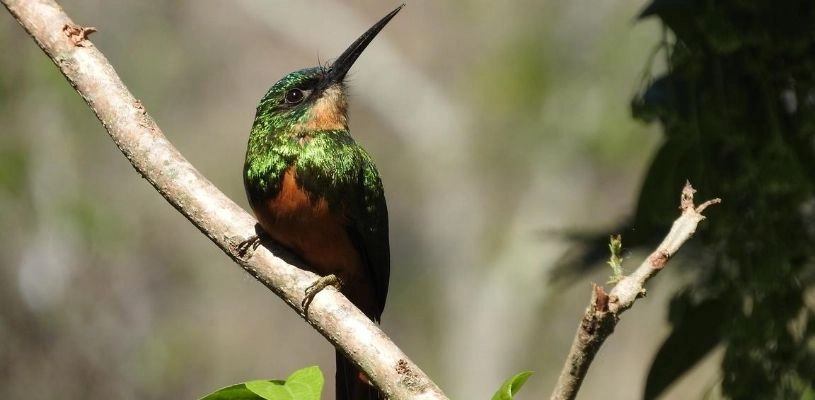
- Hummingbirds feeding on orchids
- The Andean cock-of-the-rock (Peru’s national bird)
- Butterflies and amphibians
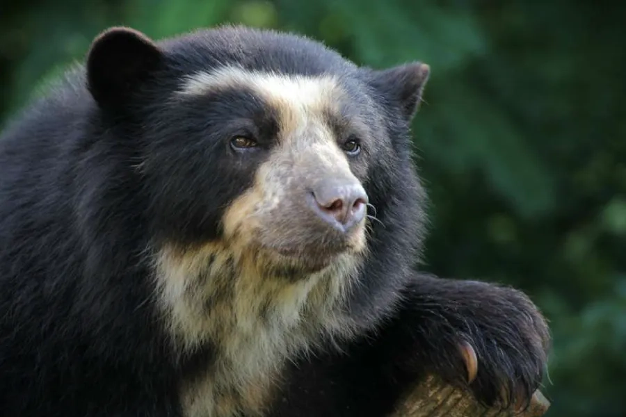
- The spectacled bear (native to the region, though rarely seen)
Water shapes everything here. Streams converge into waterfalls that cascade down steep slopes, eventually feeding the Santa Teresa River system below.
The shift from alpine silence to jungle sound is immediate and unmistakable.
4. High Jungle and Tropical Valleys
Lucmabamba & Santa Teresa Region
As elevation drops further, the ecosystem transitions fully into tropical agriculture supported by fertile soils and warm temperatures.
Landscape
Dense green forest surrounds river canyons. Vegetation becomes layered and thick. The Urubamba River basin begins to define the geography as you approach the Machu Picchu region.
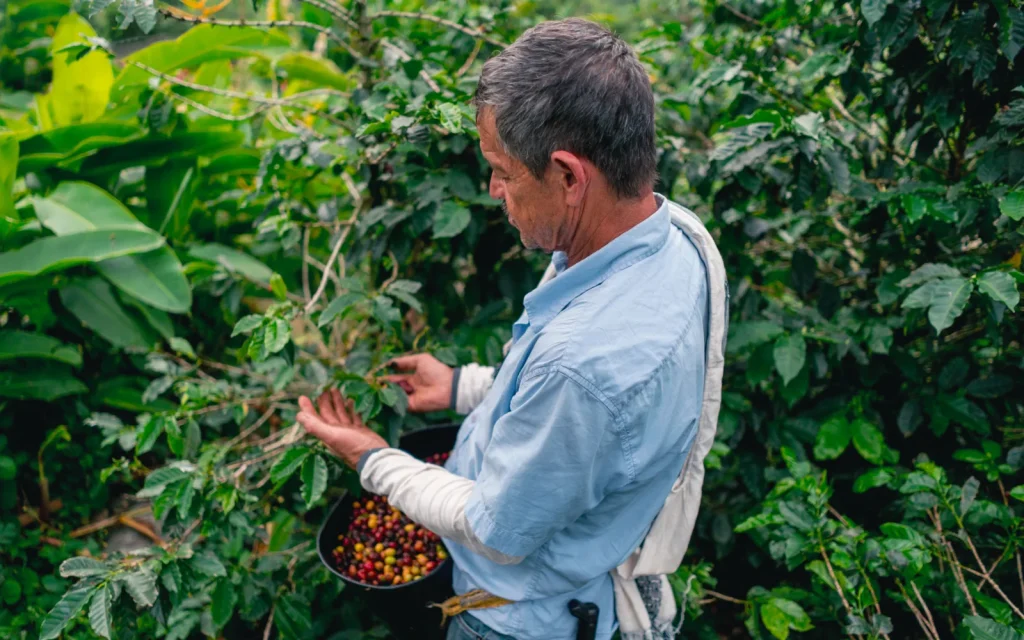
Agriculture
The fertile environment supports:
- Organic coffee plantations
- Cacao fields
- Passion fruit
- Avocados
- Bananas
Unlike the high valleys at the start of the trek, agriculture here feels distinctly tropical.
Experiential Dimension
This ecological shift is not abstract. It becomes tangible.
Trekkers often walk directly through coffee farms. Fresh fruit may be harvested along the route. Produce grown in these valleys frequently appears at the dining table during the journey.
The food experience reflects the ecosystem, locally grown ingredients shaped by altitude and climate.
How These Ecosystems Interact
The Salkantay corridor works as a vertical ecological chain.
- Glacial meltwater from high peaks feeds lower agricultural valleys.
- The Andes force Amazonian air masses upward, creating cloud forest humidity.
- The mountains generate a rain-shadow effect, shaping where moisture accumulates.
- Birds and insects move seeds between zones, maintaining biodiversity corridors.
- Rivers born in ice fields sustain tropical agriculture days later downstream.
The system is interconnected. Remove one layer, and the balance shifts.
This vertical compression, glacier to jungle in under a week, is a product of elevation, not latitude. Few places on Earth offer such rapid ecological contrast within walking distance.
Vegetation Change: A Day-by-Day Progression
The shift becomes especially clear when viewed chronologically:
Day 1: Crops, grasslands, irrigated valleys
Day 2: Alpine Puna and high-altitude bunchgrass
Day 3: Ferns, moss, orchids, and increasing humidity
Day 4: Tropical fruit, coffee plants, dense jungle vegetation
Each day feels botanically distinct. The plant life alone signals the transition between worlds.
Fauna: What You’re Most Likely to See
Realistic expectations matter.
Most common sightings:
- Llamas and alpacas
- Andean birds of prey
- Hummingbirds
- Butterflies in the cloud forest
Possible but rare:
- Condors
- Spectacled bears
- Larger jungle mammals
Wildlife visibility depends on season, time of day, and trail traffic. Early mornings tend to offer the best chances for bird activity.
Why the Salkantay Route Is Ecologically Unique
Many trekking routes feature glaciers. Others traverse tropical forests. Few combine both in a single continuous passage.
Compared to more consolidated routes like the Inca Trail, the Salkantay corridor spans a broader vertical ecological spectrum. You experience raw alpine exposure and Amazon-influenced biodiversity within the same journey.
It feels less like walking toward a single destination and more like crossing ecological regions stacked on top of each other.
Biodiversity of the Salkantay Trek
Wildlife You Might Spot Along the Salkantay Route
| Species | Ecosystem / Where to Find It | Short Description |
| Andean Condor (Vultur gryphus) | High Puna near Salkantay Pass | One of the world’s largest flying birds. Massive wingspan (up to 3 meters). Often seen soaring on thermal currents. Rare but iconic. |
| Andean Fox (Lycalopex culpaeus) | Andean Meadows & High Valleys | Small, adaptable predator with reddish-gray fur. Usually spotted at dawn or dusk near open grasslands. |
| Vicuña (Vicugna vicugna) | High Puna grasslands | Wild relative of the llama. Slim build, extremely fine wool. Typically seen grazing in small groups at high altitude. |
| Llama & Alpaca (Lama glama / Vicugna pacos) | Andean Meadows | Domesticated camelids grazing near farming communities. Integral to Andean culture and agriculture. |
| Andean Caracara (Phalcoboenus megalopterus) | Open Valleys & Puna | Bold, ground-foraging raptor. Frequently seen walking rather than flying. Scavenger and opportunistic hunter. |
| Andean Cock-of-the-Rock (Rupicola peruvianus) | Cloud Forest (Ceja de Selva) | Peru’s national bird. Bright orange-red plumage in males. Found in humid forested ravines. Most active at dawn. |
| Hummingbirds (multiple species) | Cloud Forest & Transition Zones | Fast-moving pollinators feeding on orchids and bromeliads. Highly active in humid, flowering areas. |
| Spectacled Bear (Tremarctos ornatus) | Cloud Forest (very rare sighting) | South America’s only native bear species. Shy and elusive. Recognizable by pale facial markings. |
| Tree Frogs & Amphibians (various species) | Cloud Forest | Thrive in humid microclimates. Often heard more than seen, especially during rainy season. |
| Toucans (various species) | High Jungle & Lower Valleys | Large, colorful beaks. Found in tropical canopy zones near Lucmabamba and Santa Teresa. |
| Butterflies (multiple tropical species) | Cloud Forest & Jungle | Extremely diverse. Bright colors increase noticeably as elevation drops. |
| River Birds (e.g., Torrent Duck) | Santa Teresa River system | Adapted to fast-moving mountain rivers. Often seen navigating strong currents. |
Plant Life You’ll Encounter Along the Salkantay Route
| Species / Plant Type | Ecosystem / Where to Find It | Short Description |
| Ichu Grass (Stipa ichu) | High Puna (above 4,000m) | Hardy Andean bunchgrass adapted to wind, cold, and intense UV exposure. Dominant vegetation near Salkantay Pass. |
| Cushion Plants (various species) | High Alpine Zones | Low-growing, compact plants that retain heat and resist strong winds. Key survival specialists of extreme altitude. |
| Lichens (symbiotic algae & fungi) | Exposed Rock Surfaces in Puna | Among the first organisms to colonize bare rock. Important for soil formation in glacial terrain. |
| Andean Polylepis (Queuña) Trees | Upper Transition Zones | High-altitude native tree with peeling reddish bark. Provides habitat for specialized bird species. |
| Tree Ferns | Cloud Forest (Ceja de Selva) | Large prehistoric-looking ferns thriving in humid, misty environments. Signal the ecological shift from alpine to jungle. |
| Orchids (multiple native species) | Cloud Forest | Epiphytic flowering plants growing on tree trunks and branches. Extremely diverse and highly adapted to humidity. |
| Bromeliads | Cloud Forest | Water-storing plants that collect rain in their leaves, creating microhabitats for insects and amphibians. |
| Mosses & Epiphytes | Cloud Forest | Dense growth on tree bark due to constant humidity. Create the “green-covered” forest appearance. |
| Coffee Plant (Coffea arabica) | High Jungle (Lucmabamba region) | Shade-grown crop cultivated in tropical valleys. Produces red coffee cherries harvested locally. |
| Cacao Tree (Theobroma cacao) | Lower Tropical Valleys | Source of chocolate. Grows in warm, humid conditions. Large pods grow directly from the trunk. |
| Banana & Plantain Trees | Tropical Valleys | Fast-growing plants with large leaves. Thrive in fertile soils of Santa Teresa region. |
| Passion Fruit (Maracuyá) | Jungle & Agricultural Zones | Climbing vine producing aromatic tropical fruit. Often incorporated into fresh juices during the trek. |
| Avocado Trees | Lower Elevations | Broad-leafed tropical tree producing nutrient-rich fruit grown in small-scale farms along the route. |
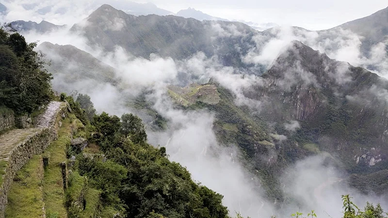
Trekking Through Vertical Geography
The Andes are not only a mountain range, they are an ecological engine. Elevation dictates temperature. Temperature dictates vegetation. Vegetation dictates wildlife. Water connects it all.
On the Salkantay route, that chain of cause and effect is visible in real time. Glacial melt becomes valley agriculture. High-altitude winds become jungle mist. Alpine silence gives way to tropical sound. From glacier to jungle, the transformation is continuous, and it happens step by step, under your own pace.
Few treks compress such geographic diversity into such a short distance. That is what makes this route more than a hike. It is a walk-through vertical ecosystem in motion.